Chesnut discovery trail (sentier découverte de la châtaigne)
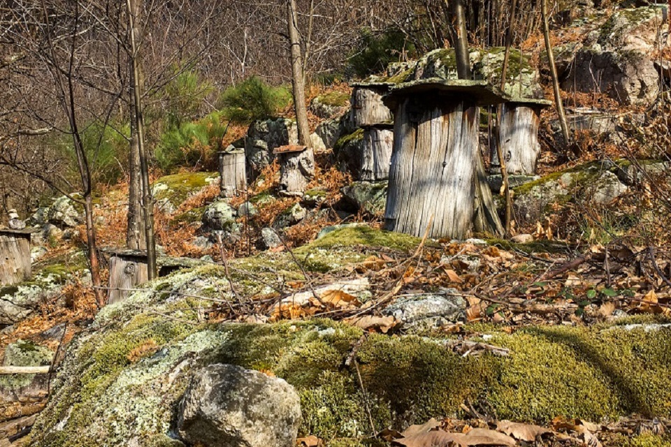
This path runs through the heart of the Sensitive Natural Area (SNA) of the Montselgues plateau and the Thines valley. It enables you to contemplate magnificent landscapes of chestnut groves, “béals” (leats or water courses) still in operation to irrigate the chestnut trees, superb views of the river Borne and its enormous granite blocks formed 300 million years ago (Geopark label), and old chestnut trees that are home to a wide variety of fauna.
Description
P - At the start sign in the hamlet of Féreyrolles, take the path that climbs to the right. This path leads to a track, turn left, then 250m further on, turn right onto the canal path. Follow the chestnut trail signs.
 In this first section, continue straight on for 1km. With the 5 red frames, use your sense of observation to identify traces of human intervention in the landscape. At the “Sardoune” theme panel, the path continues downhill to a small road.
- Turn right and walk 300m. Go down the path on the left until you reach the canal. Turn left and you’ll see a sign marked “le Béal”.
- Cross the canal and continue along the path on the left. Walk through the chestnut orchards and then a meadow where there’s a third panel with a 19th century illustration of a landscape of the Borne valley.
- At the end of the meadow, continue on the track, turning left to reach another theme sign entitled “l’arbre à pain” (Europe’s version of the breadfruit tree). After 50m, take the road.
- To continue along the initial trail, take the road left then, at the crossroads, go right. Walk along this small road for 350m. (For the return trip, you can take the road on your right to get to the Geopark site. If you take this 600m detour, you’ll discover a geological curiosity – “balls” of polished granite that fell onto the riverbed several million years ago).
- Take the path on the right to reach a chestnut orchard. Continue straight ahead on the path past the information panel “les châtaignes d'Ardèche”.
- At the end of the trail, take the road again and head left to return to the hamlet of Féreyrolles.
You can also carry straight on by following the road then taking a small path on your right. This additional 1.5km loop, which takes about half an hour, takes you past a goat farm. Cross the road when you get to the stone cross, climb up to the old canal and go left to return to Féreyrolles.
- Departure : Hamlet of Féreyrolles, Sainte-Marguerite-Lafigère
- Arrival : Hamlet of Féreyrolles, Sainte-Marguerite-Lafigère
- Towns crossed : SAINTE-MARGUERITE-LAFIGERE and MONTSELGUES
Forecast
Altimetric profile
Prepare my journey
Information desks
Office de tourisme des Cévennes d'Ardèche
Joyeuse/Les Vans
Transport
Access and parking
Parking :