The mills of Saint-André-Lachamp
SAINT-ANDRE-LACHAMP
The mills of Saint-André-Lachamp
Hard
4h30
12,1km
+580m
-582m
Loop
PR
Embed this item to access it offline
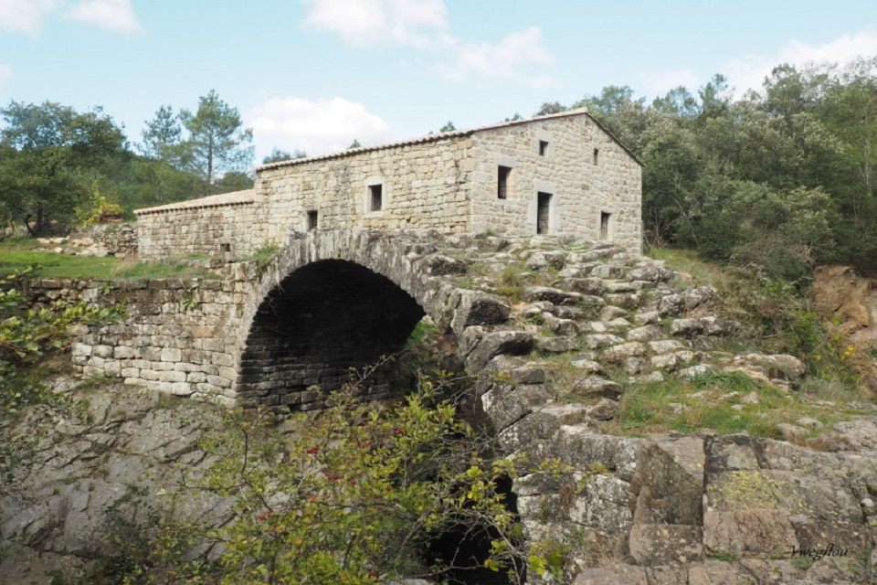
As early as the Middle Ages, the Alune River was used to turn numerous mills for the region’s inhabitants. There are still four mills along the trail that used the water held back in a “sluice”.
Description
From the Town Hall car park ( ), head towards Saint-Mélany, then go left on the D 450 towards Les Prés de Lachamp.
-
 Les Prés de Lachamp - Follow "Peyronne 4,4 km, Planzolles 6,4 km" on the edge of the meadow to the farm track into the wood. Leave the track by a path that goes down to the left to join another track. Take the track to the right until you reach the tarmac road. Once on the RD 450, turn left and follow it round the hairpin bends. On the right, take the road that leads to Le Vernet.
 - Le Vernet - Follow "Peyronne 2,6 km, Planzolles 4,6 km". Leave the road by a path down to the hamlet of Estevenet. In the hamlet, take a path that goes down on your left past a house. The path crosses some meadows at the end of which you have to turn left to follow the river. Follow the river until you reach a stone path on the right that leads to the Vermale bridge. After the bridge, go up through the pines to Peyronne.
- Peyronne - Follow "Les Mines 1,7 km, Saint-André-Lachamp 7,8 km".
- Roustalou - Follow "Les Mines 1,6 km, Saint-André-Lachamp 7,7 km". The track becomes a path and descends to the mines. Continue along the track and cross the industrial ruin of Roustalou, then cross a wooden bridge back over the Alune. Continue along the track to the road and then on to Les Mines.
- Les Mines - Follow "Saint-André-Lachamp 6,1 km". Go down the road for a few metres and turn left. Go past the Gournier mill and continue to the first house in Le Chambon. The path goes up to the road. Turn right and continue for 10 metres to the RD 450. Cross the road and take the stairs in the retaining walls. Go up along the edge of the field and join a farm track. Follow the track. Pass the houses of Fourès and Raynal. You have reached Le Serre.
- Le Serre - Follow "Saint-André-Lachamp 2,1 km". Walk past a water reservoir and take the track up to Le Besset. Cross the road and continue to Saint-André-Lachamp.
- Departure : Town Hall, Saint-André-Lachamp
- Arrival : Town Hall, Saint-André-Lachamp
- Towns crossed : SAINT-ANDRE-LACHAMP and PLANZOLLES
Forecast
Altimetric profile
Prepare my journey
Information desks

Office de tourisme des Cévennes d'Ardèche
Joyeuse/Les Vans
Transport
Let us limit travel by car, think of public transport and carpooling. All public transport on transports-region-auvergne-rhone-alpes
Access and parking
From Les Vans (27 km) follow Joyeuse. From Joyeuse (14 km) follow Ribes then Saint-André-Lachamp.
Parking :
Town hall, Saint andré lachamp