Les Flaüts
With this family hike, you can explore the area’s wealth of exceptional heritage such as the undated graves dug into the sandstone and the Flaüts fountain.
Description
P - Turn left opposite the signpost. Follow the tarmac road for a few metres and turn right onto a dirt track, then turn left down the steps to the Alune stream. Cross the stream at a ford, turn right and walk along the river until you reach a small submersible bridge where you can cross back over the stream. Twenty metres after the bridge, turn right onto a path that leads up to the village through chestnut trees and vineyards. When you reach the tarmac road, turn left to leave the hamlet. Before the bridge, turn right between the houses and go up to the street. Turn left to Mas de Laffont.
-
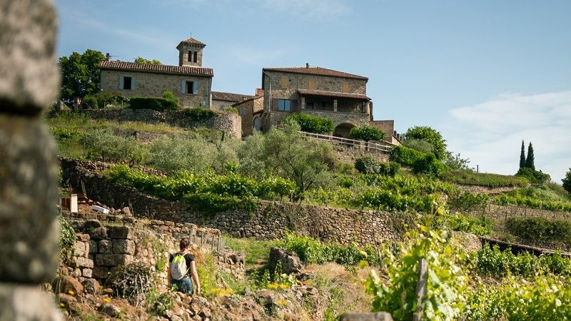
 Mas de Laffont - Follow Prades 2,6 km, Ribes 0,6 km. Pass the Flaüts fountain and then take the tarmac road to the right. At the hairpin bend, turn right. After a bend, pass the rubbish collection point, take a path on the left that climbs between the vines. Cross over the tarmac road and take the steps between the houses up to the church in the middle of Ribes.
 - Ribes - Follow Prades 2 km, Saint André Lachamp 6,9 km. When you reach the first houses, turn left to take a small alley in the hamlet of Les Clots. Take the tarmac road at the hairpin bend. Take the road to the left that goes up to Le Serre.
- Le Serre - Follow Prades 1,4 km. The road winds upwards to the last houses. The trail continues via steps on the side of the mountain and then curves right. As you begin to descend, ignore the track to your left and continue along the path. After descending, join the track, and go left until you get to Prades.
- Prades - Follow Info Rando 2,7 km, Ribes 1,6 km. Continue along the path on the right. About 100m further on, take the path that leads to the hamlet of Labeaume. Pass through the entire hamlet then carry on until you reach the hamlet of Le Gelly via the tarmac road.
- Le Gelly - Follow Info rando 1,2 km, Joyeuse 4,5 km. Take the road and at the first crossroads, go right. Continue straight on until you’re level with a stone cross. After a chestnut grove, at the stone cross, leave the road via a “calade” or stone path down to Le Prat.
- Le Prat - Follow Info rando 0,6 km. At the crossroads, go down the steps on the left and follow the path that brings you back to the multi-purpose hall.
- Departure : Salle polyvalente (multi-purpose hall), Ribes
- Arrival : Salle polyvalente (multi-purpose hall), Ribes
- Towns crossed : RIBES and LABLACHÈRE
Forecast
Altimetric profile
Prepare my journey
Information desks

Office de tourisme des Cévennes d'Ardèche
Joyeuse/Les Vans
Transport
Let us limit travel by car, think of public transport and carpooling. All public transport on transports-region-auvergne-rhone-alpes
Access and parking
From Les Vans (23 km) follow Joyeuse then Ribes.
From Joyeuse (7 km) follow Ribes.
Parking :