Around Loubaresse
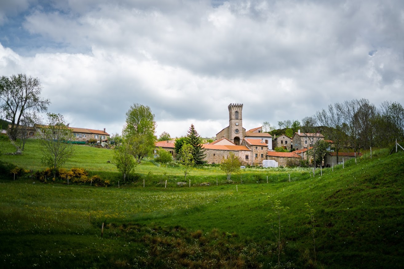
LOUBARESSE
Around Loubaresse
Medium
3h
5,6km
+283m
-292m
Loop
GR
PR
Embed this item to access it offline
You can explore the meadows around Loubaresse, the smallest village in the Ardeche with its population of around only thirty people. The passages along the ridge offer stunning views in fine weather, especially early in the morning and late afternoon.
Description
P - ( ) From the "Loubaresse départ" post near the church, join the upper road (
 ), cross over and climb the transhumance sheep track to the windy Pratarabiat pass
-
 Pratarabiat – Follow Borne 5,9 km. Take the track on the left along the ridge.
 - Bravefont - Follow Loubaresse 1,4 km. Leave the track to descend steeply between two fences on the left (
 ).
). - Croix de Saint-Jean - Follow Loubaresse 2,2 km. On the right, cross the hairpin-bend road. Continue through the meadows. To reach the village, leave the track for vehicles to the Loubaresse’s only hamlet (Lichechaude) and take the path to the Lichechaude stream. Cross the stream and go up to join the GR (
 ) below the farm-restaurant.
 - Le Dervet - Follow Loubaresse 0,7 km. Go left to return to Place de Loubaresse.
- Departure : Circular fountain, Place de Loubaresse
- Arrival : Circular fountain, Place de Loubaresse
- Towns crossed : LOUBARESSE and BORNE
Forecast
Altimetric profile
Prepare my journey
Information desks

Office de tourisme des Cévennes d'Ardèche
Joyeuse/Les Vans
Transport
Let us limit travel by car, think of public transport and carpooling. All public transport on transports-region-auvergne-rhone-alpes
Access and parking
Depuis Les Vans (38km) suivre Saint-Laurent-Les-Bains puis Loubaresse. Depuis Joyeuse (36km) suivre Valgorge puis Loubaresse.
Parking :
Town Hall car park, Loubaresse