Le Pléjadou (n°10p)
This small circuit spans the Sure valley and takes you on an exploration of the Cevennes paths steeped in the area’s important agricultural history.
Description
P – Go down to the church via the road
- Follow the signs

- L'Eglise - Follow Croix de Lenne 0,2 km (
 ).
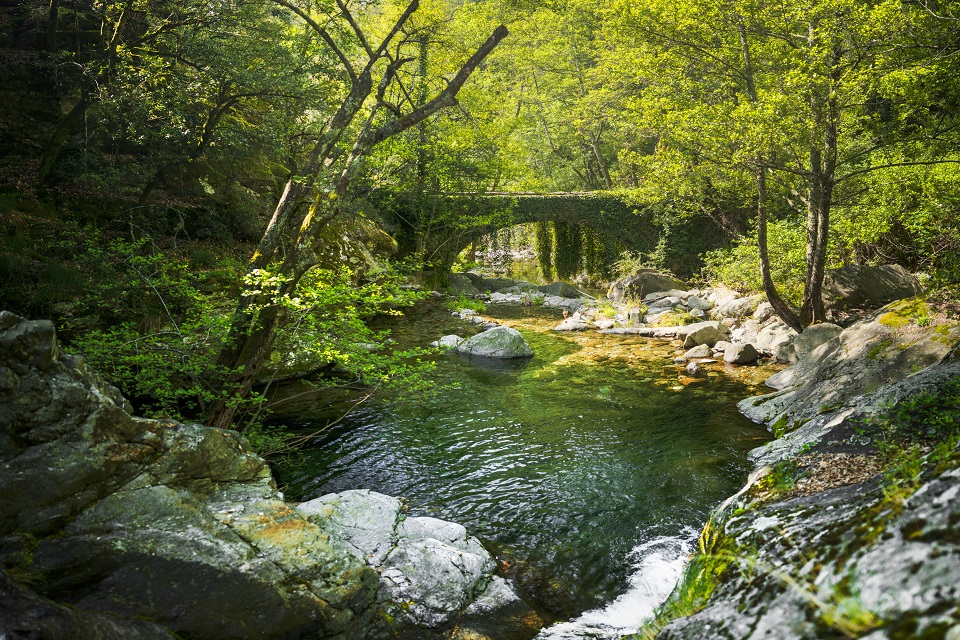
). - Croix de Lenne - Follow Vigne Merle 0,5km. Head up the road for a few metres and take the track leading down to the right.
- Vigne Merle - Follow Le Puech 1,4 km. Pass the Vigne Merle bridge and go up to Le Puech. On your left you can see a big flat stone with a large notch in it – a pléjadou!
- Le Puech - Follow Les Alrassets 0,9 km. Cross the hamlet and take the path that leads down to the left.
- Les Alrassets - Follow La Planche 0,8 km. Go down to the La Planche bridge.
- La Planche - Follow Croix de Lenne 1,1 km until you reach it. At the intersection, return to the car park.
- Departure : Point info randonnée (Hiking Information Point), Saint-Jean-de-Pourcharesse
- Arrival : Point info randonnée (Hiking Information Point), Saint-Jean-de-Pourcharesse
- Towns crossed : SAINT-PIERRE-SAINT-JEAN
Forecast
Altimetric profile
Prepare my journey
Recommandations
Cette agréable boucle autour de Saint-Jean-de-Pourcharesse offre un concentré de patrimoine et de nature cévenole. Entre châtaigneraies, murets de pierre, ponts anciens et hameaux pittoresques, le parcours révèle la richesse du bâti rural et des savoir-faire d’autrefois. Une randonnée courte mais pleine de charme, où chaque détour évoque la vie paysanne traditionnelle et la beauté tranquille du paysage ardéchois.
Carte IGN 2838OT
Information desks

Office de tourisme des Cévennes d'Ardèche
Joyeuse/Les Vans
Transport
Let us limit travel by car, think of public transport and carpooling. All public transport on transports-region-auvergne-rhone-alpes
Access and parking
From Les Vans (18 km), cross Chambonas, Faugères and Payzac.
From Joyeuse (19 km), go through Lablachère, Payzac and Faugères.
Parking :