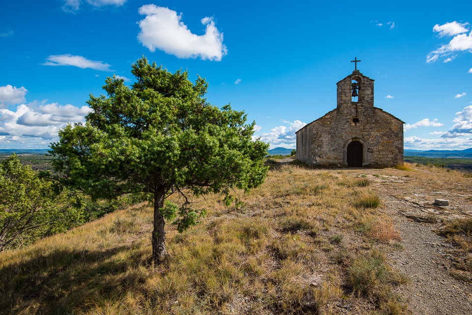
Saint Appolonie chapel (n°22)
LES ASSIONS
Saint Appolonie chapel (n°22)
Medium
3h30
9,1km
+345m
-348m
Loop
Yellow markup
Embed this item to access it offline
This is a great circuit to explore the architectural wealth of the village of Les Assions and its sandstone houses, low walls, fountains, steps and much more.
Description
P – From the Town Hall car park, follow the signs () to the Boutonette Bridge.
-
 La Boutonette Bridge - Follow La Boutonette 1,1 km.
 - La Boutonette - Follow Champetier Haut 1,1 km.
- Champetier Haut - Follow Téraube 1 km.
- Téraube - Follow Fude 1,1 km.
- Fude - Follow Puech 1,2 km.
- Puech - At the crossroads, go right and, 300m further on, take the path that climbs to the summit, to the Sainte Appolonie chapel. Retrace your steps and follow Le Bosc 0,3 km.
- Le Bosc - Follow Boudoux 0,3 km.
- Boudoux - Follow Les Massots 2,1 km.
- Les Massots - Follow Chef Lieu 0,5 km to return to the Town Hall car park.
- Departure : Town Hall car park, Les Assions
- Arrival : Town Hall car park, Les Assions
- Towns crossed : LES ASSIONS and PAYZAC
Forecast
Altimetric profile
Prepare my journey
Recommandations
Partez tôt le matin ou en fin d'après-midi pour éviter la chaleur. Protégez-vous du soleil avec de la crème solaire, un chapeau et des lunettes de soleil. Emportez de l’eau, des encas, et choisissez un itinéraire dégagé comme des crêtes. Vérifiez la météo et adaptez votre rythme pour rester en sécurité. Bonne aventure !
Carte IGN 2839OT
Information desks

Office de tourisme des Cévennes d'Ardèche
Joyeuse/Les Vans
Transport
Let us limit travel by car, think of public transport and carpooling. All public transport on transports-region-auvergne-rhone-alpes
Access and parking
From Les Vans (6 km), follow the D901 and the D104a. Take the D352 to reach Les Assions. From Joyeuse (10 km), follow the D104 and join the D352 to reach Les Assions.
Parking :
Town Hall car park, Les Assions